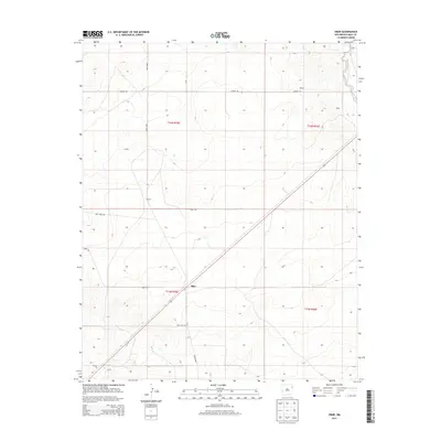
2013 Map of Obar
USGS Topo · Published 2013About this map
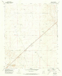
Obar sits at the heart of this high plains landscape in eastern Quay County, situated where a diagonal rail line intersects the local road network. The small settlement is anchored by the nearby Obar Cem, providing a focal point for genealogical research in this sparsely populated region. The terrain is defined by wide sections of open land, occasionally broken by named localities such as Bullock, Nelson, and Hughs, which likely represent family ranching hubs or former rail sidings. Along the eastern edge, the West Fork Nara Visa Arroyo carves a subtle drainage path through the topography. Evidence of local industry appears in the southwest corner with a designated Gravel Pit. The map is structured by a rigorous grid of section lines and gravel roads, including Obar Rd and Lockney Rd, reflecting the organized agricultural and ranching layout of the New Mexico borderlands.
Find a feature on this map
16 named features on this map. Tap any name to fly to it.
Don’t see what you’re looking for? This feature index may not catch every label — zoom into the map to look around manually.
Map Details
Editions of this 2013 Obar Map
This is the sole edition of this map. No revisions or reprints were ever made.
Other maps of this area
1954 · Tucumcari
USGS Topo · 1:250,000
1958 · Tucumcari
USGS Topo · 1:250,000
1962 · Logan
USGS Topo · 1:62,500
1966 · Cherokee Valley
USGS Topo · 1:24,000
1966 · Lockney
USGS Topo · 1:24,000
1968 · Cammak Camp
USGS Topo · 1:24,000
1968 · Sanchez Springs
USGS Topo · 1:24,000
1971 · Kerlin Hill
USGS Topo · 1:24,000
1971 · Doyle Hill
USGS Topo · 1:24,000
1971 · Obar
USGS Topo · 1:24,000