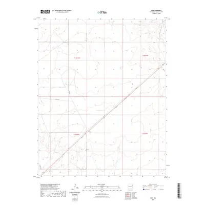
2023 Map of Obar
USGS Topo · Published 2023About this map
The high plains of eastern New Mexico define the landscape around the small settlement of Obar, situated along the diagonal path of Bell St. This region in Quay County is characterized by large township and range divisions, such as t16n r35e and t15n r36e, which organize the rural terrain. Water sources are sparse, limited to the West Fork Nara Visa Arroyo in the northeast and Sager Draw in the southwest, reflecting the arid nature of the Llano Estacado. For local history and genealogy, the Obar Cem stands as a significant landmark just south of the main settlement. The road network, including Quay Road L and Lockney Rd, provides a clear view of the modern infrastructure connecting these remote ranching and farming communities.
Find a feature on this map
13 named features on this map. Tap any name to fly to it.
Don’t see what you’re looking for? This feature index may not catch every label — zoom into the map to look around manually.
Map Details
Editions of this 2023 Obar Map
This is the sole edition of this map. No revisions or reprints were ever made.
Other maps of this area

1954 · Tucumcari
USGS Topo · 1:250,000

1958 · Tucumcari
USGS Topo · 1:250,000

1962 · Logan
USGS Topo · 1:62,500

1966 · Cherokee Valley
USGS Topo · 1:24,000

1966 · Lockney
USGS Topo · 1:24,000

1968 · Cammak Camp
USGS Topo · 1:24,000

1968 · Sanchez Springs
USGS Topo · 1:24,000

1971 · Kerlin Hill
USGS Topo · 1:24,000

1971 · Doyle Hill
USGS Topo · 1:24,000

1971 · Obar
USGS Topo · 1:24,000