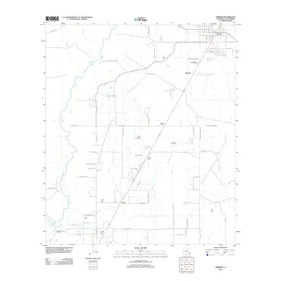
2012 Map of Oberlin
USGS Topo · Published 2012About this map
Oberlin serves as the focal point of this Allen Parish landscape, situated near the headwaters of the Calcasieu River. The settlement pattern reflects a mixture of agricultural roots and significant energy extraction, evidenced by the South Oberlin Oil Field and the Pilgrim Church Gas Field. Local infrastructure is marked by a grid of rural roads like Ward Line Rd and Nursery Rd, which connect smaller communities such as Bernard, Elder, and Lyles.
Find a feature on this map
71 named features on this map. Tap any name to fly to it.
Don’t see what you’re looking for? This feature index may not catch every label — zoom into the map to look around manually.
Map Details
Editions of this 2012 Oberlin Map
This is the sole edition of this map. No revisions or reprints were ever made.
Other maps of this area

1935 · Mittie
USGS Topo · 1:31,680

1947 · Kinder
USGS Topo · 1:31,680

1947 · Foley
USGS Topo · 1:31,680

1947 · Oberlin
USGS Topo · 1:31,680

1947 · Pine Chapel
USGS Topo · 1:31,680

1947 · Le Blanc
USGS Topo · 1:31,680

1947 · Elton
USGS Topo · 1:31,680

1947 · Edna
USGS Topo · 1:31,680
1948 · Mittie
USGS Topo · 1:24,000
1948 · Pine Chapel
USGS Topo · 1:24,000