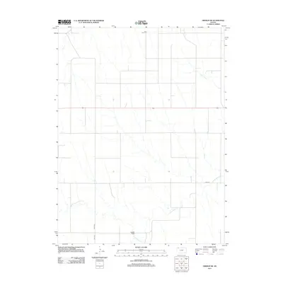
2012 Map of Oberlin SW
USGS Topo · Published 2012About this map
The rolling plains of Rawlins County are defined here by a series of intermittent watercourses that drain the northwestern Kansas landscape. N Fork Sappa Cr meanders across the lower half of the quadrangle, joined by smaller drainage systems such as Johnson Draw and Lambs Draw. This 2012 survey illustrates a sparsely populated agricultural region, where a precise grid of rural roads, including Co HWY-459, organizes the territory into large parcels. For those tracing local heritage, Saint Johns Cem serves as a lone, significant landmark in the northern portion of the sheet. The layout reflects the enduring rural character of the Great Plains, where transportation is centered on corridors like US Highway 36, which cuts through the central portion of the map, providing a primary link between the surrounding farming communities and regional hubs.
Find a feature on this map
8 named features on this map. Tap any name to fly to it.
Don’t see what you’re looking for? This feature index may not catch every label — zoom into the map to look around manually.
Map Details
Editions of this 2012 Oberlin SW Map
This is the sole edition of this map. No revisions or reprints were ever made.
Other maps of this area

1951 · Selden
USGS Topo · 1:62,500

1951 · Herndon
USGS Topo · 1:62,500

1951 · Achilles
USGS Topo · 1:62,500

1951 · Oberlin
USGS Topo · 1:62,500

1954 · Goodland
USGS Topo · 1:250,000

1956 · Goodland
USGS Topo · 1:250,000

1957 · Goodland
USGS Topo · 1:250,000

1965 · Oberlin
USGS Topo · 1:24,000

1965 · Oberlin SW
USGS Topo · 1:24,000

1965 · Achilles
USGS Topo · 1:24,000