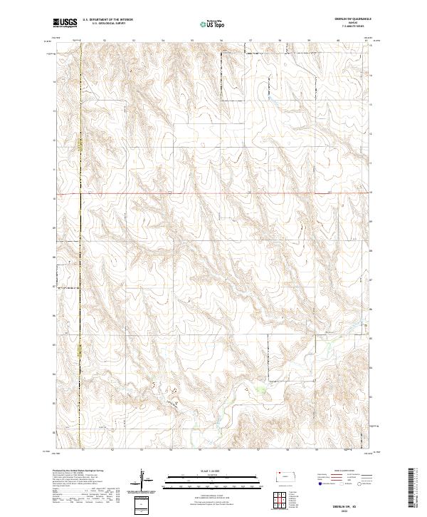
2022 Map of Oberlin SW
USGS Topo · Published 2022About this map
Saint Johns Cem rests on the high plains along the northern boundary of this survey, overlooking a landscape defined by the drainage patterns of the N Fork Sappa Cr. The terrain is characterized by a network of seasonal watercourses including Johnson Draw and Lambs Draw, which carve deep incisions into the prairie. This area straddles the county line between Rawlins Co and Decatur Co, where the rectilinear grid of the Public Land Survey System dictates the placement of rural corridors like Co Rd 8 W and 500th Rd. The map illustrates a contemporary agricultural environment where movement is confined to these established section lines, reflecting the enduring legacy of the Homestead Act in shaping the spatial organization of the Kansas high plains.
Find a feature on this map
20 named features on this map. Tap any name to fly to it.
Don’t see what you’re looking for? This feature index may not catch every label — zoom into the map to look around manually.
Map Details
Editions of this 2022 Oberlin SW Map
This is the sole edition of this map. No revisions or reprints were ever made.
Other maps of this area

1951 · Selden
USGS Topo · 1:62,500

1951 · Herndon
USGS Topo · 1:62,500

1951 · Achilles
USGS Topo · 1:62,500

1951 · Oberlin
USGS Topo · 1:62,500

1954 · Goodland
USGS Topo · 1:250,000

1956 · Goodland
USGS Topo · 1:250,000

1957 · Goodland
USGS Topo · 1:250,000

1965 · Oberlin
USGS Topo · 1:24,000

1965 · Oberlin SW
USGS Topo · 1:24,000

1965 · Achilles
USGS Topo · 1:24,000