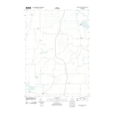
2010 Map of Observatory Hill
USGS Topo · Published 2010About this map
Observatory Hill rises as a prominent landmark in this section of Marquette County, overlooking a landscape defined by the winding courses of the Grand River and French Creek. The map shows a rural environment where land use is closely tied to the regional hydrology, most notably at the Grand River Marsh where the 3WR220 Dam regulates the water. In the southern portion of the quadrangle, the legacy of early industry remains visible at Dates Millpond and the Dates Mill Dam.
Find a feature on this map
46 named features on this map. Tap any name to fly to it.
Don’t see what you’re looking for? This feature index may not catch every label — zoom into the map to look around manually.
Map Details
Editions of this 2010 Observatory Hill Map
This is the sole edition of this map. No revisions or reprints were ever made.
Other maps of this area

1902 · Portage
USGS Topo · 1:62,500

1915 · Neshkoro
USGS Topo · 1:48,000

1918 · Neshkoro
USGS Topo · 1:62,500

1955 · Randolph
USGS Topo · 1:62,500

1957 · Madison
USGS Topo · 1:250,000

1960 · Madison
USGS Topo · 1:250,000

1961 · Montello
USGS Topo · 1:62,500

1962 · Portage
USGS Topo · 1:62,500

1963 · Neshkoro
USGS Topo · 1:62,500
1980 · Marquette
USGS Topo · 1:24,000