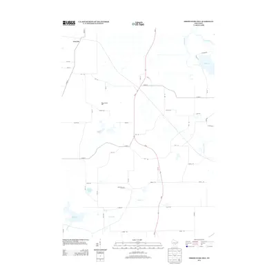
2013 Map of Observatory Hill
USGS Topo · Published 2013About this map
Glen Oak sits in the northern reaches of this rural landscape, which is defined by a dense network of minor waterways and small basins. The terrain is dominated by Observatory Hill and characterized by its unique hydrography, featuring multiple distinct water bodies including Madden Lakes, Knights Lake, and Dates Millpond. These water features feed into systems like French Cr and Belle Fountain Cr, reflecting a region deeply tied to its glacial drainage patterns. The convergence of Wi-22 with county routes such as Co HWY-B and Co HWY-O suggests a community structure oriented around agricultural transit and local connectivity. In the northeast, the Grand River and Fox River brush the edges of the sheet, further anchoring the area as a significant riparian corridor in Marquette County.
Find a feature on this map
43 named features on this map. Tap any name to fly to it.
Don’t see what you’re looking for? This feature index may not catch every label — zoom into the map to look around manually.
Map Details
Editions of this 2013 Observatory Hill Map
This is the sole edition of this map. No revisions or reprints were ever made.
Other maps of this area

1902 · Portage
USGS Topo · 1:62,500

1915 · Neshkoro
USGS Topo · 1:48,000

1918 · Neshkoro
USGS Topo · 1:62,500

1955 · Randolph
USGS Topo · 1:62,500

1957 · Madison
USGS Topo · 1:250,000

1960 · Madison
USGS Topo · 1:250,000

1961 · Montello
USGS Topo · 1:62,500

1962 · Portage
USGS Topo · 1:62,500

1963 · Neshkoro
USGS Topo · 1:62,500
1980 · Marquette
USGS Topo · 1:24,000