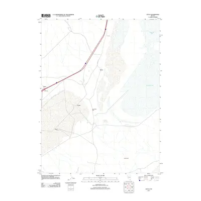
2011 Map of Ocala
USGS Topo · Published 2011About this map
Humboldt Lake dominates the eastern landscape of this high-desert region in Churchill County, where the water's edge meets the engineered structures of the Humboldt Dike. The transit corridor is defined by the US 95 Interchange and the accompanying Frontage Rd, which connect a series of small named locations such as Trinity, Miriam, and Cressid. These points, along with Toy Mill, reflect the region's sparse but deliberate industrial and logistical footprint. To the south, the terrain rises toward Topog Peak, while the namesake settlement of Ocala sits at a crossroads in the arid flats. The map illustrates a modern desert environment where large-scale hydrology and major interstate infrastructure intersect with the remnants of older land-use patterns in the Great Basin.
Find a feature on this map
10 named features on this map. Tap any name to fly to it.
Don’t see what you’re looking for? This feature index may not catch every label — zoom into the map to look around manually.
Map Details
Editions of this 2011 Ocala Map
This is the sole edition of this map. No revisions or reprints were ever made.
Other maps of this area

1908 · Carson Sink
USGS Topo · 1:250,000

1910 · Carson Sink
USGS Topo · 1:250,000

1931 · Lovelock
USGS Topo · 1:250,000

1935 · Lovelock
USGS Topo · 1:250,000

1951 · Carson Sink
USGS Topo · 1:62,500

1951 · Desert Peak
USGS Topo · 1:62,500

1955 · Lovelock
USGS Topo · 1:250,000

1956 · Toulon
USGS Topo · 1:62,500

1957 · Reno
USGS Topo · 1:250,000

1959 · Lovelock
USGS Topo · 1:250,000