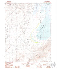
1986 Map of Ocala
USGS Topo · Published 1986About this map
St Anthony Mine and several scattered Prospects mark the southern reaches of the Trinity Range in the mid-1980s. This arid landscape is defined by the stark transition from mountain peaks to the vast Alkali Flat expanses of the Fortymile Desert. Water management and transportation legacy are evident in the complex of lake beds and dikes, including Lower Humboldt Lake and Toulon Lake, which are bordered by a significant Wildlife Management Area.
Find a feature on this map
29 named features on this map. Tap any name to fly to it.
Don’t see what you’re looking for? This feature index may not catch every label — zoom into the map to look around manually.
Map Details
Editions of this 1986 Ocala Map
This is the sole edition of this map. No revisions or reprints were ever made.
Other maps of this area

1908 · Carson Sink
USGS Topo · 1:250,000

1910 · Carson Sink
USGS Topo · 1:250,000

1931 · Lovelock
USGS Topo · 1:250,000

1935 · Lovelock
USGS Topo · 1:250,000

1951 · Carson Sink
USGS Topo · 1:62,500

1951 · Desert Peak
USGS Topo · 1:62,500

1955 · Lovelock
USGS Topo · 1:250,000

1956 · Toulon
USGS Topo · 1:62,500

1957 · Reno
USGS Topo · 1:250,000

1959 · Lovelock
USGS Topo · 1:250,000