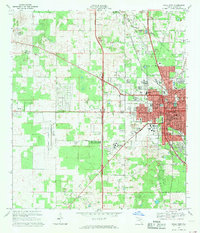
1968 Map of Ocala West
USGS Topo · Published 1969About this map
The western edge of Ocala dominates this late-1960s landscape, where urban development meets horse country and industrial quarrying. The city's growth is evident near Central Florida Jr College and Howard High Sch, while the expansive Ocala Municipal Airport Jim Taylor Field anchors the southwestern quadrant. To the north and west, the terrain rises toward Mt Tabor, peppered with numerous limestone quarries and specialized agriculture, including the Golden Hills Turf and Country Club. Transportation networks are heavily represented by the Seaboard Coast Line and remnants of the past like the Old Railroad Grade. This survey captures a moment of transition for Martel and the surrounding area, balancing community landmarks like Lincoln Mem Cem and Good Shepherd Memorial Gardens (Cem) against the encroaching suburban footprint of Ocala Ridge.
Find a feature on this map
51 named features on this map. Tap any name to fly to it.
Don’t see what you’re looking for? This feature index may not catch every label — zoom into the map to look around manually.
Map Details
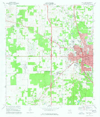
Editions of this 1968 Ocala West Map
2 editions found
Other maps of this area

1892 · Dunnellon
USGS Topo · 1:62,500

1893 · Citra
USGS Topo · 1:62,500

1894 · Dunnellon
USGS Topo · 1:62,500

1895 · Williston
USGS Topo · 1:62,500

1895 · Citra
USGS Topo · 1:62,500

1895 · Ocala
USGS Topo · 1:62,500

1954 · Cotton Plant
USGS Topo · 1:24,000

1954 · Dunnellon SE
USGS Topo · 1:24,000

1954 · Dunnellon
USGS Topo · 1:62,500

1954 · Gainesville
USGS Topo · 1:250,000