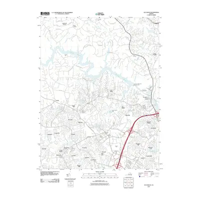
2010 Map of Occoquan
USGS Topo · Published 2010About this map
The Occoquan Reservoir and the Occoquan River dominate the northern landscape of this Prince William County survey, illustrating the complex intersection of water management and suburban expansion. The community of Occoquan sits below the Occoquan Main Dam, while to the south, the massive residential developments of Dale City and Woodbridge show the dense suburban grid characteristic of the early 21st century. Regional history is preserved in small pockets, such as Davis Cemetery and Ebenezer Cemetery, which sit near modern thoroughfares like the Prince William Pkwy. The presence of the State Prison Camp (Number 6) and the sprawling Potomac Mills commercial area highlights the diverse land use in this Northern Virginia corridor, where former rural landmarks like Hoadly and Agnewville have been absorbed into a continuous residential landscape.
Find a feature on this map
98 named features on this map. Tap any name to fly to it.
Don’t see what you’re looking for? This feature index may not catch every label — zoom into the map to look around manually.
Map Details
Editions of this 2010 Occoquan Map
This is the sole edition of this map. No revisions or reprints were ever made.
Other maps of this area

1890 · Mt. Vernon
USGS Topo · 1:125,000

1891 · Mt. Vernon
USGS Topo · 1:125,000

1894 · Mt. Vernon
USGS Topo · 1:125,000

1897 · Mt. Vernon
USGS Topo · 1:125,000

1900 · Washington
USGS Topo · 1:62,500

1913 · Indian Head
USGS Topo · 1:62,500

1915 · Fairfax
USGS Topo · 1:62,500

1923 · Indian Head
USGS Topo · 1:48,000

1925 · Indian Head
USGS Topo · 1:62,500

1927 · Quantico
USGS Topo · 1:62,500