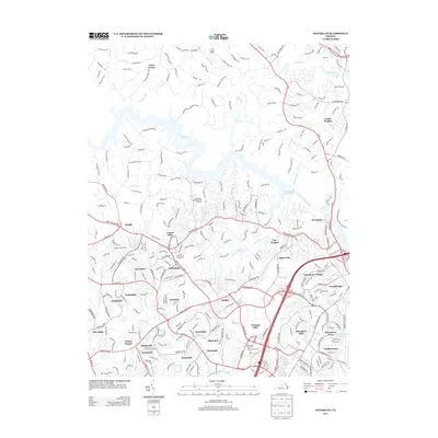
2013 Map of Occoquan
USGS Topo · Published 2013About this map
Occoquan Reservoir and the Occoquan River dominate the central geography of this Northern Virginia landscape, serving as a defining boundary between sprawling residential developments and protected green spaces. The map illustrates a dense network of suburban communities that characterize the early 21st-century growth in Prince William County, including Marumsco Village, Woodbridge, and Potomac Mills. Notable land use is varied, ranging from the recreational Lake Ridge Golf Park and Marina and Fountainhead Regional Park to the institutional State Prison Camp Number 6. The transition from established town centers like Occoquan to the numerous named subdivisions like Darbydale, Forestdale, and Kerrydale reflects the intensive late-century residential infill of the corridor. Smaller geographic features like Hooes Run and Sandy Run provide a natural counterpoint to the heavy infrastructure of the Fairfax County Pkwy and surrounding commuter routes.
Find a feature on this map
285 named features on this map. Tap any name to fly to it.
Don’t see what you’re looking for? This feature index may not catch every label — zoom into the map to look around manually.
Map Details
Editions of this 2013 Occoquan Map
This is the sole edition of this map. No revisions or reprints were ever made.
Other maps of this area

1890 · Mt. Vernon
USGS Topo · 1:125,000

1891 · Mt. Vernon
USGS Topo · 1:125,000

1894 · Mt. Vernon
USGS Topo · 1:125,000

1897 · Mt. Vernon
USGS Topo · 1:125,000

1900 · Washington
USGS Topo · 1:62,500

1913 · Indian Head
USGS Topo · 1:62,500

1915 · Fairfax
USGS Topo · 1:62,500

1923 · Indian Head
USGS Topo · 1:48,000

1925 · Indian Head
USGS Topo · 1:62,500

1927 · Quantico
USGS Topo · 1:62,500