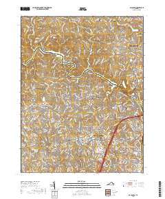
2019 Map of Occoquan
USGS Topo · Published 2019About this map
The Occoquan River carves a deep, winding boundary between Fairfax and Prince William counties, anchoring a landscape that bridges suburban expansion with preserved family history. Numerous small burial grounds are scattered throughout the northern reaches, including the Hampton Family Cem, Fairfax-Buckley Family Cem, and Davis Family Cem, suggesting the agrarian legacy of the region before the growth of modern communities like Lake Ridge and Dale City. The presence of the Potomac Heritage National Scenic Trail along the riverbanks highlights the area's transition into a recreation-focused corridor. To the south, heavy development around Potomac Mills and the diverse neighborhoods of Marumsco Hills and Marumsco Village contrast with the older, established cores of Occoquan and Agnewville. Smaller creeks like Neabsco Cr and South Run continue to define the drainage patterns of this heavily populated Virginia interior.
Find a feature on this map
48 named features on this map. Tap any name to fly to it.
Don’t see what you’re looking for? This feature index may not catch every label — zoom into the map to look around manually.
Map Details
Editions of this 2019 Occoquan Map
This is the sole edition of this map. No revisions or reprints were ever made.
Other maps of this area

1890 · Mt. Vernon
USGS Topo · 1:125,000

1891 · Mt. Vernon
USGS Topo · 1:125,000

1894 · Mt. Vernon
USGS Topo · 1:125,000

1897 · Mt. Vernon
USGS Topo · 1:125,000

1900 · Washington
USGS Topo · 1:62,500

1913 · Indian Head
USGS Topo · 1:62,500

1915 · Fairfax
USGS Topo · 1:62,500

1923 · Indian Head
USGS Topo · 1:48,000

1925 · Indian Head
USGS Topo · 1:62,500

1927 · Quantico
USGS Topo · 1:62,500