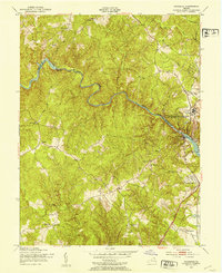
1951 Map of Occoquan
USGS Topo · Published 1953About this map
Occoquan Creek serves as the winding natural boundary between Fairfax and Prince William Counties in this early 1950s survey. The landscape is defined by the transition from rural upland settlements like Farrs Corner and Hoadly to the emerging riverside corridors of Occoquan and Woodbridge. Industry and infrastructure are concentrated along the water, featuring a Filtration Plant, Pumping Station, and the Ryan Dam, alongside a Power Station (Abandoned) that hints at the area's evolving utility needs.
Find a feature on this map
39 named features on this map. Tap any name to fly to it.
Don’t see what you’re looking for? This feature index may not catch every label — zoom into the map to look around manually.
Map Details
Editions of this 1951 Occoquan Map
This is the sole edition of this map. No revisions or reprints were ever made.
Other maps of this area

1890 · Mt. Vernon
USGS Topo · 1:125,000

1891 · Mt. Vernon
USGS Topo · 1:125,000

1894 · Mt. Vernon
USGS Topo · 1:125,000

1897 · Mt. Vernon
USGS Topo · 1:125,000

1900 · Washington
USGS Topo · 1:62,500

1913 · Indian Head
USGS Topo · 1:62,500

1915 · Fairfax
USGS Topo · 1:62,500

1923 · Indian Head
USGS Topo · 1:48,000

1925 · Indian Head
USGS Topo · 1:62,500

1927 · Quantico
USGS Topo · 1:62,500