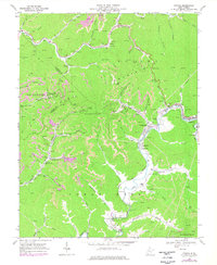
1968 Map of Oceana
USGS Topo · Published 1977About this map
Huff Mountain dominates this landscape, where the coal industry of Wyoming and Logan counties is visible through numerous strip mines and tipples. The Norfolk and Western railway follows the winding path of Western Creek and the Clear Fork, serving as the industrial backbone for settlements like Oceana and Lillydale. Small mountain communities such as Cyclone and Campus are connected by narrow roads following the drainages of Huff Creek and Toney Fork. Educational and spiritual life in these hollows is anchored by the Coal Mountain Sch, Road Branch Sch, and local churches like Cyclone Ch. The presence of a Lookout Tower on Burning Rock and a Filtration Plant near Lillyhaven reflects the infrastructure required to manage these resource-rich highlands in the late 1960s.
Find a feature on this map
65 named features on this map. Tap any name to fly to it.
Don’t see what you’re looking for? This feature index may not catch every label — zoom into the map to look around manually.
Map Details
Editions of this 1968 Oceana Map
4 editions found
Other maps of this area

1891 · Oceana
USGS Topo · 1:125,000

1893 · Oceana
USGS Topo · 1:125,000

1898 · Oceana
USGS Topo · 1:125,000

1909 · Gilbert
USGS Topo · 1:48,000

1910 · Pineville
USGS Topo · 1:48,000

1910 · Bald Knob
USGS Topo · 1:48,000

1912 · Bald Knob
USGS Topo · 1:62,500

1912 · Gilbert
USGS Topo · 1:62,500

1912 · Pineville
USGS Topo · 1:62,500

1913 · Logan
USGS Topo · 1:62,500