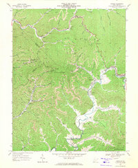
1968 Map of Oceana
USGS Topo · Published 1971About this map
Deep hollows and industrial activity define this late-1960s survey of the Wyoming and Logan County line. The town of Oceana anchors the eastern edge of the sheet along the N & W railroad, while smaller settlements like Coal Mountain and Lillydale are tucked into the narrow valleys formed by Clear Fork and Huff Creek. This geography reveals a landscape deeply connected to resource extraction and topography, with numerous Mine sites, strip mines, and gas wells dotting the hillsides of Oceana Mountain.
Find a feature on this map
62 named features on this map. Tap any name to fly to it.
Don’t see what you’re looking for? This feature index may not catch every label — zoom into the map to look around manually.
Map Details
Editions of this 1968 Oceana Map
4 editions found
Other maps of this area

1891 · Oceana
USGS Topo · 1:125,000

1893 · Oceana
USGS Topo · 1:125,000

1898 · Oceana
USGS Topo · 1:125,000

1909 · Gilbert
USGS Topo · 1:48,000

1910 · Pineville
USGS Topo · 1:48,000

1910 · Bald Knob
USGS Topo · 1:48,000

1912 · Bald Knob
USGS Topo · 1:62,500

1912 · Gilbert
USGS Topo · 1:62,500

1912 · Pineville
USGS Topo · 1:62,500

1913 · Logan
USGS Topo · 1:62,500