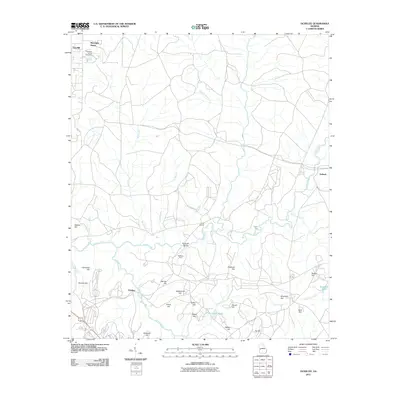
2011 Map of Ochillee
USGS Topo · Published 2011About this map
Upatoi Creek winds through this landscape, serving as a central drainage point for numerous tributaries like Wolf Creek and Long Branch. This area, surveyed in 2011, reflects a legacy of institutional and rural land use near Columbus, Georgia. Notable sites include the Muscogee County Poor Farm and Muscogee Manor in the northwest, while the small settlement of Ochillee is located to the south near Ochillee Creek.
Find a feature on this map
37 named features on this map. Tap any name to fly to it.
Don’t see what you’re looking for? This feature index may not catch every label — zoom into the map to look around manually.
Map Details
Editions of this 2011 Ochillee Map
This is the sole edition of this map. No revisions or reprints were ever made.
Other maps of this area

1907 · Talbotton
USGS Topo · 1:125,000

1908 · Columbus
USGS Topo · 1:62,500

1929 · Columbus
USGS Topo · 1:48,000

1947 · Columbus
USGS Topo · 1:62,500

1949 · Midland
USGS Topo · 1:24,000

1949 · Glen Alta
USGS Topo · 1:24,000

1949 · Upatoi
USGS Topo · 1:24,000

1949 · Ochillee
USGS Topo · 1:24,000

1949 · Buena Vista NW
USGS Topo · 1:24,000

1949 · Columbus
USGS Topo · 1:24,000