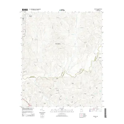
2014 Map of Ochillee
USGS Topo · Published 2014About this map
The boundary between Muscogee and Chattahoochee counties follows the meandering course of Upatoi Creek, a central feature of this terrain near Columbus. The landscape is defined by numerous named elevations such as Cleveland Hill, Wadsworth Hill, and Griswold Hill, which rise between a network of waterways including Ochillee Creek and Randall Creek. In the eastern portion of the survey, the settlement of Eelbeck sits near the crossing of Pine Knot Creek. Historic transit points and crossings are well-documented, including McBrides Bridge, McBride Ford, and Turkey Ford, providing specific locations for genealogical and local history research. Toward the northwest, residential developments like Muscogee Manor and Forest Hills appear alongside Green Acres Cemetery, illustrating the suburban growth surrounding the regional hub.
Find a feature on this map
79 named features on this map. Tap any name to fly to it.
Don’t see what you’re looking for? This feature index may not catch every label — zoom into the map to look around manually.
Map Details
Editions of this 2014 Ochillee Map
This is the sole edition of this map. No revisions or reprints were ever made.
Other maps of this area

1907 · Talbotton
USGS Topo · 1:125,000

1908 · Columbus
USGS Topo · 1:62,500

1929 · Columbus
USGS Topo · 1:48,000

1947 · Columbus
USGS Topo · 1:62,500

1949 · Midland
USGS Topo · 1:24,000

1949 · Glen Alta
USGS Topo · 1:24,000

1949 · Upatoi
USGS Topo · 1:24,000

1949 · Ochillee
USGS Topo · 1:24,000

1949 · Buena Vista NW
USGS Topo · 1:24,000

1949 · Columbus
USGS Topo · 1:24,000