
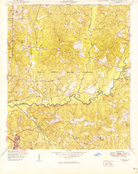
1949 Map of Ochillee
USGS Topo · Published 1949About this map
The Fort Benning Military Reservation dominates this landscape along the border of Muscogee and Chattahoochee counties, reflecting the military expansion of the post-World War II era. Significant transit corridors define the area's development, including the Central of Georgia and Seaboard Air Line railroads, which cross the terrain near the settlement of Ochillee. The presence of the Landing Field and several institutional sites such as the County Hospital and County Farm indicate a complex local infrastructure supporting both the military installation and the surrounding civilian community.
Find a feature on this map
30 named features on this map. Tap any name to fly to it.
Don’t see what you’re looking for? This feature index may not catch every label — zoom into the map to look around manually.
Map Details
Editions of this 1949 Ochillee Map
2 editions found
Other maps of this area

1907 · Talbotton
USGS Topo · 1:125,000

1908 · Columbus
USGS Topo · 1:62,500

1929 · Columbus
USGS Topo · 1:48,000

1947 · Columbus
USGS Topo · 1:62,500

1949 · Midland
USGS Topo · 1:24,000

1949 · Glen Alta
USGS Topo · 1:24,000

1949 · Upatoi
USGS Topo · 1:24,000

1949 · Buena Vista NW
USGS Topo · 1:24,000

1949 · Columbus
USGS Topo · 1:24,000

1949 · Cusseta
USGS Topo · 1:24,000