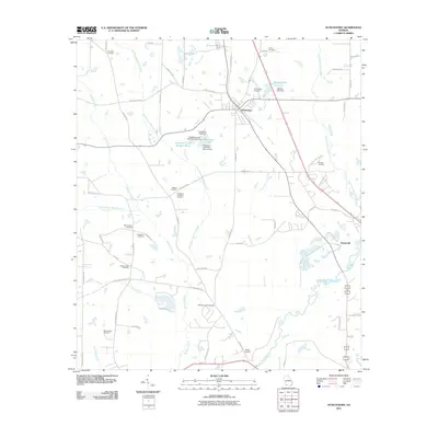
2011 Map of Ochlocknee
USGS Topo · Published 2011About this map
Ochlocknee serves as the primary hub in this southwest Georgia landscape, situated north of the Ochlocknee River as it meanders through the coastal plain. The settlement pattern is defined by a high density of family and community burial grounds, such as Springhill Cemetery, Jones Cemetery, and the Ochlocknee Cemetery near the town center. The presence of Singletary Lake, controlled by structures like Singletary Lake Dam Number Three, highlights the managed water systems common in this region's agricultural and recreational history. Further east, the small community of Dawesville borders the river, while the land between is etched by numerous watercourses including East Branch Barnetts Creek and Pine Creek. These creeks and the many rural roads, such as Dollar Store Rd, provide a clear view of the rural infrastructure and land divisions that have sustained this portion of Thomas County into the early 21st century.
Find a feature on this map
64 named features on this map. Tap any name to fly to it.
Don’t see what you’re looking for? This feature index may not catch every label — zoom into the map to look around manually.
Map Details
Editions of this 2011 Ochlocknee Map
This is the sole edition of this map. No revisions or reprints were ever made.
Other maps of this area

1953 · Dothan
USGS Topo · 1:250,000

1953 · Waycross
USGS Topo · 1:250,000

1954 · Dothan
USGS Topo · 1:250,000

1954 · Valdosta
USGS Topo · 1:250,000

1954 · Tallahassee
USGS Topo · 1:250,000

1955 · Dothan
USGS Topo · 1:250,000

1956 · Cairo
USGS Topo · 1:62,500

1957 · Thomasville
USGS Topo · 1:62,500

1958 · Valdosta
USGS Topo · 1:250,000

1958 · Waycross
USGS Topo · 1:250,000