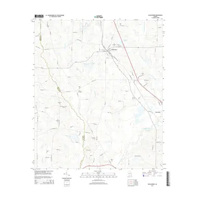
2014 Map of Ochlocknee
USGS Topo · Published 2014About this map
Ochlocknee serves as the primary hub for this Georgia landscape, situated at the junction of the area's principal road and rail corridors. The town is flanked by a dense network of local routes, including Main St N and Railroad St E, which branch out toward the rural settlements of Dawesville and the winding course of the Ochlocknee River. This map reveals a significant concentration of family and community burial grounds, such as Singletary Cem Number 1, Barnetts Creek Cem, and Montgomery Cem, reflecting a deep genealogical history within the county. The hydrology is dominated by the Little Ochlocknee River and several distinct bodies of water including Singletary Lake and Beverly Lake. The boundary between Grady and Thomas County meanders through the western portion of the sheet, largely following the natural path of Barnetts Creek.
Find a feature on this map
103 named features on this map. Tap any name to fly to it.
Don’t see what you’re looking for? This feature index may not catch every label — zoom into the map to look around manually.
Map Details
Editions of this 2014 Ochlocknee Map
This is the sole edition of this map. No revisions or reprints were ever made.
Other maps of this area

1953 · Dothan
USGS Topo · 1:250,000

1953 · Waycross
USGS Topo · 1:250,000

1954 · Dothan
USGS Topo · 1:250,000

1954 · Valdosta
USGS Topo · 1:250,000

1954 · Tallahassee
USGS Topo · 1:250,000

1955 · Dothan
USGS Topo · 1:250,000

1956 · Cairo
USGS Topo · 1:62,500

1957 · Thomasville
USGS Topo · 1:62,500

1958 · Valdosta
USGS Topo · 1:250,000

1958 · Waycross
USGS Topo · 1:250,000