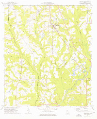
1974 Map of Ochlocknee
USGS Topo · Published 1976About this map
Ochlocknee and the neighboring community of Dawesville serve as the primary centers of gravity in this southwestern Georgia landscape, where the Seaboard Coast Line railroad dictates the local development pattern. The terrain is defined by a dense network of tributaries including Horse Creek, Barnetts Creek, and Wilson Creek feeding into the Ochlocknee River. This 1974 survey captures a rural social geography anchored by numerous country churches such as Bold Springs Ch, Mt Nebo Ch, and Hadley Ch. Local industry and land use are evidenced by several clay pits and sandpits concentrated near the watercourses. Genealogists will find particular value in the distribution of family-named landmarks and resting places, such as the Hendry Cem, Montgomery Cem, and Walden Cem, which highlight the area's established family roots during the mid-1970s.
Find a feature on this map
33 named features on this map. Tap any name to fly to it.
Don’t see what you’re looking for? This feature index may not catch every label — zoom into the map to look around manually.
Map Details
Editions of this 1974 Ochlocknee Map
This is the sole edition of this map. No revisions or reprints were ever made.
Other maps of this area

1953 · Dothan
USGS Topo · 1:250,000

1953 · Waycross
USGS Topo · 1:250,000

1954 · Dothan
USGS Topo · 1:250,000

1954 · Valdosta
USGS Topo · 1:250,000

1954 · Tallahassee
USGS Topo · 1:250,000

1955 · Dothan
USGS Topo · 1:250,000

1956 · Cairo
USGS Topo · 1:62,500

1957 · Thomasville
USGS Topo · 1:62,500

1958 · Valdosta
USGS Topo · 1:250,000

1958 · Waycross
USGS Topo · 1:250,000