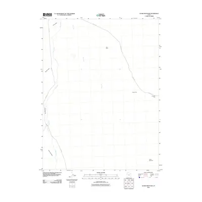
2010 Map of Ochre Mountain
USGS Topo · Published 2010About this map
Ochre Mountain dominates the southeastern corner of this Tooele County landscape, where the high desert terrain transitions between prominent peaks and broad, arid basins. This 2010 survey illustrates a region defined by its traditional transit corridors and water drainage patterns, notably the path of Ibapah Rd as it skirts White Sage Flat and follows the course of Deep Creek through the Deep Creek Valley. To the northeast, Gold Hill Rd winds through Gold Hill Pass and past Pinyon Flat, providing a clear record of the routes connecting isolated landmarks like Twin Peaks. The drainage network, including Ferber Wash and Bar Creek, highlights the intermittent water sources that dictate the character of this West Desert environment, while Gerster Gulch offers a glimpse into the localized topography that has long challenged travelers and surveyors alike.
Find a feature on this map
12 named features on this map. Tap any name to fly to it.
Don’t see what you’re looking for? This feature index may not catch every label — zoom into the map to look around manually.
Map Details
Editions of this 2010 Ochre Mountain Map
This is the sole edition of this map. No revisions or reprints were ever made.
Other maps of this area

1925 · Gold Hill
USGS Topo · 1:62,500

1928 · Gold Hill
USGS Topo · 1:62,500

1953 · Tooele
USGS Topo · 1:250,000

1955 · Tooele
USGS Topo · 1:250,000

1955 · Elko
USGS Topo · 1:250,000

1958 · Elko
USGS Topo · 1:250,000

1962 · Elko
USGS Topo · 1:250,000

1965 · Elko
USGS Topo · 1:250,000

1972 · Utah Peak
USGS Topo · 1:24,000

1972 · Elephant Knoll
USGS Topo · 1:24,000