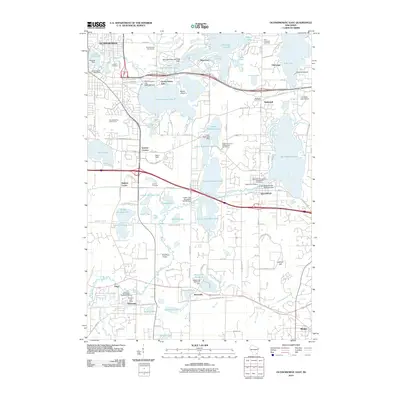
2010 Map of Oconomowoc East
USGS Topo · Published 2010About this map
Oconomowoc and Delafield anchor this landscape defined by an intricate network of glacial lakes and the winding Bark River. The map highlights a transition from dense lakeside settlements to the institutional grounds of University Lake School and the Nashotah House Episcopalian Cemetery. Significant local history is preserved in the numerous burial grounds, including La Belle Cemetery and Saint John Chrysostom Episcopalian Cemetery, which serve as quiet landmarks among the water-bound topography.
Find a feature on this map
123 named features on this map. Tap any name to fly to it.
Don’t see what you’re looking for? This feature index may not catch every label — zoom into the map to look around manually.
Map Details
Editions of this 2010 Oconomowoc East Map
This is the sole edition of this map. No revisions or reprints were ever made.
Other maps of this area

1892 · Watertown
USGS Topo · 1:62,500

1892 · Oconomowoc
USGS Topo · 1:62,500

1892 · Whitewater
USGS Topo · 1:62,500

1892 · Eagle
USGS Topo · 1:62,500

1893 · Whitewater
USGS Topo · 1:62,500

1894 · Watertown
USGS Topo · 1:62,500

1894 · Eagle
USGS Topo · 1:62,500

1897 · Eagle
USGS Topo · 1:62,500

1903 · Whitewater
USGS Topo · 1:62,500

1906 · Eagle
USGS Topo · 1:62,500