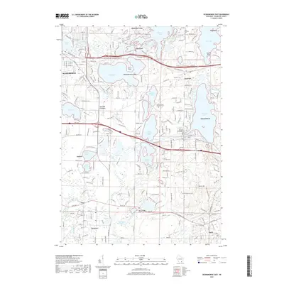
2018 Map of Oconomowoc East
USGS Topo · Published 2018About this map
The Oconomowoc Lake region in Waukesha County is defined by a dense network of glacial lakes and historical settlements that shaped the development of southeastern Wisconsin. Major water bodies including Nagawicka Lake, Okauchee Lake, and Upper Nemahbin Lake dominate the landscape, interconnected by the winding Bark River and Oconomowoc River. This map captures the area during a period of modern connectivity, where traditional lakefront communities like Nashotah, Chenequa, and Delafield are linked by the Watertown Plank Rd and the Ice Age National Scenic Trail.
Find a feature on this map
65 named features on this map. Tap any name to fly to it.
Don’t see what you’re looking for? This feature index may not catch every label — zoom into the map to look around manually.
Map Details
Editions of this 2018 Oconomowoc East Map
This is the sole edition of this map. No revisions or reprints were ever made.
Other maps of this area

1892 · Watertown
USGS Topo · 1:62,500

1892 · Oconomowoc
USGS Topo · 1:62,500

1892 · Whitewater
USGS Topo · 1:62,500

1892 · Eagle
USGS Topo · 1:62,500

1893 · Whitewater
USGS Topo · 1:62,500

1894 · Watertown
USGS Topo · 1:62,500

1894 · Eagle
USGS Topo · 1:62,500

1897 · Eagle
USGS Topo · 1:62,500

1903 · Whitewater
USGS Topo · 1:62,500

1906 · Eagle
USGS Topo · 1:62,500