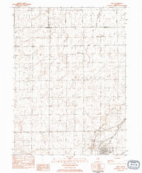
1983 Map of Odell
USGS Topo · Published 1983About this map
The village of Odell serves as the focal point for this 1980s landscape, situated at the junction of the Illinois Central Gulf railroad and several local townships. The surrounding prairie is defined by the drainage patterns of the Mazon River and its West Fork, where agricultural tracts meet the small rural settlements of Budd, Sunbury, and Nevada. This survey captures the region as its early railroad-dependent infrastructure transitioned into the modern era, preserving the locations of numerous community landmarks including St Bernard Ch and a concentration of rural burial grounds like Union Cem and Township Cem. Further north, Conrail tracks bisect the map, illustrating the heavy industrial rail presence that shaped the tri-county border of La Salle, Grundy, and Livingston counties.
Find a feature on this map
26 named features on this map. Tap any name to fly to it.
Don’t see what you’re looking for? This feature index may not catch every label — zoom into the map to look around manually.
Map Details
Editions of this 1983 Odell Map
This is the sole edition of this map. No revisions or reprints were ever made.
Other maps of this area

1935 · Pontiac
USGS Topo · 1:62,500

1939 · Pontiac
USGS Topo · 1:62,500

1947 · Cullom
USGS Topo · 1:62,500

1948 · Dwight
USGS Topo · 1:62,500

1949 · Cullom
USGS Topo · 1:62,500

1950 · Dwight
USGS Topo · 1:62,500

1958 · Odell
USGS Topo · 1:62,500

1958 · Aurora
USGS Topo · 1:250,000

1958 · Peoria
USGS Topo · 1:250,000

1961 · Aurora
USGS Topo · 1:250,000