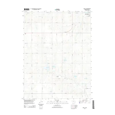
2014 Map of Odell NE
USGS Topo · Published 2014About this map
Beatrice anchors the northeastern corner of this 2014 survey, where the street grid transitions into the expansive agricultural landscape of Gage County. The terrain is defined by a dense network of seasonal and perennial waterways, most notably the meandering path of Sicily Creek and its various tributaries including Ash Creek and Bottle Creek. This era of land management is clearly visible through a series of water control structures, including Big Indian Creek Reservoir 14-A and Snyder Reservoir, which dot the drainage basins. For those researching local history, the map identifies the small community of Ellis and its corresponding Ellis Cemetery, along with Pleasant Hill Cemetery located further south. These sites, situated among a regular grid of section roads like W Osage Road and W Linden Road, mark the enduring footprints of early prairie settlements.
Find a feature on this map
36 named features on this map. Tap any name to fly to it.
Don’t see what you’re looking for? This feature index may not catch every label — zoom into the map to look around manually.
Map Details
Editions of this 2014 Odell NE Map
This is the sole edition of this map. No revisions or reprints were ever made.
Other maps of this area

1955 · Lincoln
USGS Topo · 1:250,000

1957 · Lincoln
USGS Topo · 1:250,000

1957 · Plymouth
USGS Topo · 1:24,000

1957 · Beatrice West
USGS Topo · 1:24,000

1957 · Beatrice East
USGS Topo · 1:24,000

1958 · Lincoln
USGS Topo · 1:250,000

1964 · Blue Springs
USGS Topo · 1:24,000

1970 · Diller NE
USGS Topo · 1:24,000
1970 · Wymore
USGS Topo · 1:24,000
1970 · Harbine
USGS Topo · 1:24,000