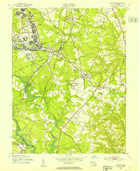
1949 Map of Odenton
USGS Topo · Published 1953About this map
Fort George G Meade Military Reservation dominates the northwestern landscape of this Anne Arundel County survey, showcasing a dense network of military infrastructure including a Rifle Range, Machine Gun Range, and Pistol Range. The area is a vital junction for mid-century transportation, where the Baltimore and Ohio and Pennsylvania railroads intersect at Odenton. The rural character of the surrounding countryside is defined by large institutional landholdings like the U S Naval Academy Dairy Farm and several historic family crossroads.
Find a feature on this map
55 named features on this map. Tap any name to fly to it.
Don’t see what you’re looking for? This feature index may not catch every label — zoom into the map to look around manually.
Map Details
Editions of this 1949 Odenton Map
This is the sole edition of this map. No revisions or reprints were ever made.
Other maps of this area

1892 · Laurel
USGS Topo · 1:62,500

1892 · Owensville
USGS Topo · 1:62,500

1894 · Laurel
USGS Topo · 1:62,500

1894 · Relay
USGS Topo · 1:62,500

1895 · Owensville
USGS Topo · 1:62,500

1897 · Laurel
USGS Topo · 1:62,500

1899 · Patuxent
USGS Topo · 1:125,000

1900 · Washington
USGS Topo · 1:62,500

1905 · Owensville
USGS Topo · 1:62,500

1906 · Patuxent
USGS Topo · 1:125,000