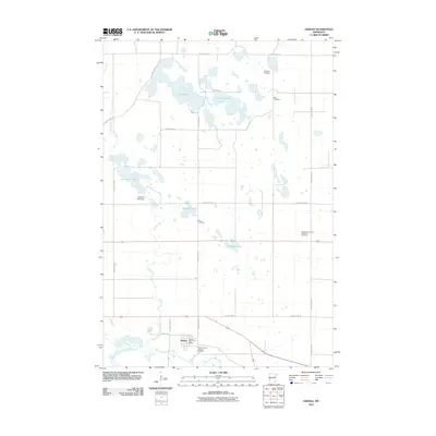
2010 Map of Odessa
USGS Topo · Published 2010About this map
The Minnesota River valley and its surrounding prairie plateau define this landscape in Big Stone County. The small community of Odessa serves as the local hub, situated near the river and the Odessa Post Office. This area is characterized by a high density of rural burial grounds, including Eidskog Cemetery, Eids Cemetery, and Odessa Trinity Lutheran Cemetery, which offer valuable data for family historians tracking early settlement patterns in the region.
Find a feature on this map
25 named features on this map. Tap any name to fly to it.
Don’t see what you’re looking for? This feature index may not catch every label — zoom into the map to look around manually.
Map Details
Editions of this 2010 Odessa Map
This is the sole edition of this map. No revisions or reprints were ever made.
Other maps of this area

1953 · Ortonville
USGS Topo · 1:62,500

1953 · Bellingham
USGS Topo · 1:62,500

1953 · Milbank
USGS Topo · 1:250,000

1958 · Milbank
USGS Topo · 1:250,000

1958 · Correll
USGS Topo · 1:24,000

1968 · Artichoke Lake NW
USGS Topo · 1:24,000

1968 · Artichoke Lake
USGS Topo · 1:24,000

1971 · Dismal Swamp
USGS Topo · 1:24,000

1971 · Odessa
USGS Topo · 1:24,000
1971 · Bellingham
USGS Topo · 1:24,000