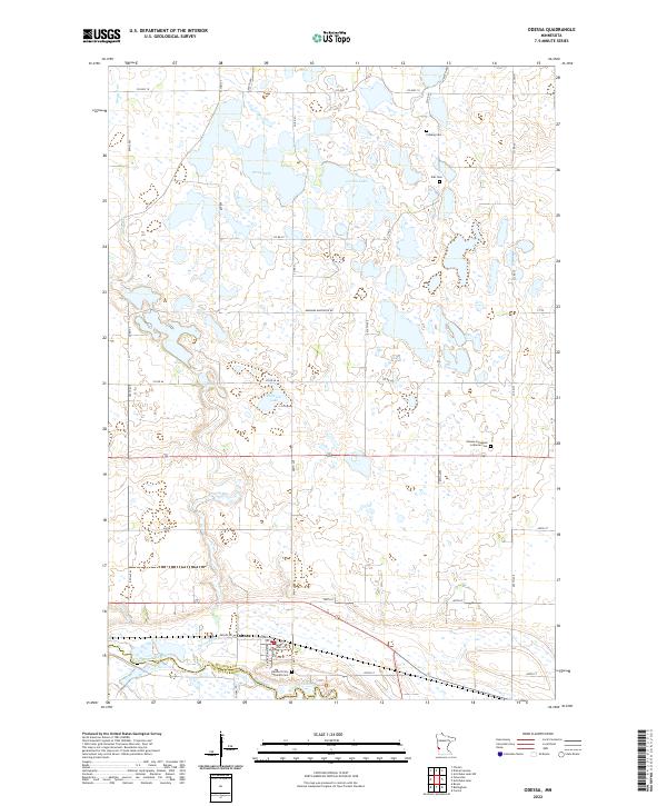
2022 Map of Odessa
USGS Topo · Published 2022About this map
Odessa sits along the northern banks of the Minnesota River, which forms the boundary between Big Stone Co and Lac Qui Parle Co. This glacial landscape is defined by its numerous prairie potholes and larger water bodies like Otrey Lake, Larson Lake, and Peterson Lake, many of which are interconnected by the winding path of Stony Run. The settlement pattern is deeply rooted in the area's ecclesiastical history, evidenced by several rural burying grounds including Eldskog Cem and Elds Cem in the northern reaches, and the Odessa Immanuel Lutheran Cem further south. The town of Odessa itself shows a traditional street grid featuring 1st St and 4th St, serving as a central hub for the surrounding agricultural townships and the Odessa Trinity Lutheran Cemetery.
Find a feature on this map
43 named features on this map. Tap any name to fly to it.
Don’t see what you’re looking for? This feature index may not catch every label — zoom into the map to look around manually.
Map Details
Editions of this 2022 Odessa Map
This is the sole edition of this map. No revisions or reprints were ever made.
Other maps of this area

1953 · Ortonville
USGS Topo · 1:62,500

1953 · Bellingham
USGS Topo · 1:62,500

1953 · Milbank
USGS Topo · 1:250,000

1958 · Milbank
USGS Topo · 1:250,000

1958 · Correll
USGS Topo · 1:24,000

1968 · Artichoke Lake NW
USGS Topo · 1:24,000

1968 · Artichoke Lake
USGS Topo · 1:24,000

1971 · Dismal Swamp
USGS Topo · 1:24,000

1971 · Odessa
USGS Topo · 1:24,000
1971 · Bellingham
USGS Topo · 1:24,000