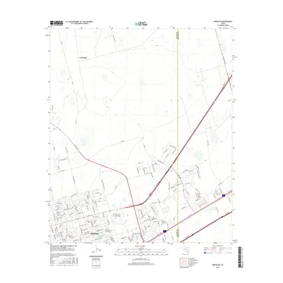
2016 Map of Odessa NE
USGS Topo · Published 2016About this map
Odessa expands northeast toward the Ector Co Midland Co line in this 2016 survey, showcasing a landscape defined by recent suburban growth and major educational infrastructure. The southern portion of the map is dominated by the sprawling campus of The Univ of Texas of the Permian Basin, situated near the intersection of the Ne Loop 338 and State Hwy 191. Residential developments such as Royal Manor and Mansion Oaks illustrate the northward push of the city into previously open terrain. To the north, the settlement of Gardendale sits along FM 554, maintaining a more dispersed character compared to the dense street grids appearing near Sunset Memorial Gardens. The transport network, including Ranch Rd 1788 and John Ben Shepperd Pkwy, reflects the region's role as a vital hub for the Permian Basin petroleum industry.
Find a feature on this map
160 named features on this map. Tap any name to fly to it.
Don’t see what you’re looking for? This feature index may not catch every label — zoom into the map to look around manually.
Map Details
Editions of this 2016 Odessa NE Map
This is the sole edition of this map. No revisions or reprints were ever made.
Other maps of this area

1954 · Hobbs
USGS Topo · 1:250,000

1954 · Pecos
USGS Topo · 1:250,000

1957 · Pecos
USGS Topo · 1:250,000

1958 · Hobbs
USGS Topo · 1:250,000

1964 · Odessa NE
USGS Topo · 1:24,000

1964 · Odessa SW
USGS Topo · 1:24,000

1964 · Odessa NW
USGS Topo · 1:24,000

1964 · Odessa SE
USGS Topo · 1:24,000

1964 · Parks
USGS Topo · 1:24,000

1965 · Southwest Midland
USGS Topo · 1:24,000