
1964 Map of Parks
USGS Topo · Published 1967About this map
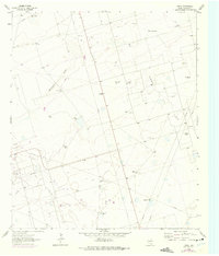
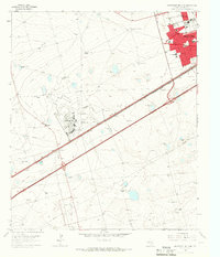
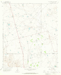
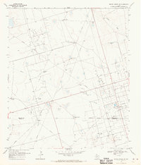
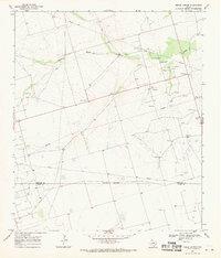
Parks Oil Field dominates this mid-1960s landscape, revealing an intricate industrial network of pipelines and support structures in the Permian Basin south of Midland. The map captures a transition in West Texas ranching and resource extraction, where the ancient path of Monahans Draw is crisscrossed by modern oil infrastructure. A remarkably high density of family-named windmills serves as the primary markers of human settlement and land use, highlighting the critical importance of water access in this arid environment. Names like the Chuck Houston Windmill, Hi Estes Windmill, and Boxcar Windmill provide a rare genealogical record of local landholders and ranching operations. The infrastructure of the petroleum industry is further detailed by the presence of a Gasoline Plant and several Pumping Sta locations, illustrating the scale of energy production during this period of Texas history.
Find a feature on this map
25 named features on this map. Tap any name to fly to it.
Don’t see what you’re looking for? This feature index may not catch every label — zoom into the map to look around manually.
Map Details
Editions of this 1964 Parks Map
2 editions found
Other maps of this area

1954 · Pecos
USGS Topo · 1:250,000

1957 · Pecos
USGS Topo · 1:250,000

1964 · Bryant Ranch
USGS Topo · 1:24,000
1964 · Odessa NE
USGS Topo · 1:24,000
1964 · Odessa SE
USGS Topo · 1:24,000
1965 · Southeast Midland
USGS Topo · 1:24,000
1965 · Southwest Midland
USGS Topo · 1:24,000
1965 · South Cowden Ranch
USGS Topo · 1:24,000
1968 · Benge Corner NW
USGS Topo · 1:24,000
1968 · Benge Corner
USGS Topo · 1:24,000