
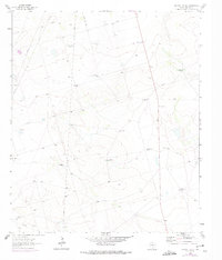
1964 Map of Bryant Ranch
USGS Topo · Published 1966About this map
Bryant Ranch serves as the namesake landmark for this 1960s survey of the Permian Basin, a landscape defined by its vital water and energy infrastructure. The map reveals an arid terrain meticulously managed through a network of numbered watering points, ranging from Windmill No 2 in the north to Windmill No 19 in the south. This dense distribution of windmills underscores the critical nature of groundwater for ranching operations in Midland County during the mid-20th century.
Find a feature on this map
15 named features on this map. Tap any name to fly to it.
Don’t see what you’re looking for? This feature index may not catch every label — zoom into the map to look around manually.
Map Details
Editions of this 1964 Bryant Ranch Map
2 editions found
Other maps of this area

1954 · Pecos
USGS Topo · 1:250,000

1954 · San Angelo
USGS Topo · 1:250,000

1957 · Pecos
USGS Topo · 1:250,000

1958 · San Angelo
USGS Topo · 1:250,000

1964 · Parks
USGS Topo · 1:24,000

1965 · San Angelo
USGS Topo · 1:250,000

1965 · Southeast Midland
USGS Topo · 1:24,000

1965 · Salt Lake
USGS Topo · 1:24,000

1965 · Southwest Midland
USGS Topo · 1:24,000
1965 · Stephenson Lake
USGS Topo · 1:24,000