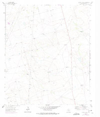
1964 Map of Bryans Ranch
USGS Topo · Published 1975About this map
Bryant Ranch serves as the focal point of this Midland County survey, illustrating the infrastructure of a working Texas cattle operation in the mid-1960s. The landscape is defined by its water management system, with numerous numbered wells such as Windmill No 3, Windmill No 8, and Windmill No 14 scattered across the terrain to support livestock. These landmarks provide a clear spatial record of ranching boundaries and water rights during this era.
Find a feature on this map
15 named features on this map. Tap any name to fly to it.
Don’t see what you’re looking for? This feature index may not catch every label — zoom into the map to look around manually.
Map Details
Editions of this 1964 Bryans Ranch Map
2 editions found
Other maps of this area

1954 · Pecos
USGS Topo · 1:250,000

1954 · San Angelo
USGS Topo · 1:250,000

1957 · Pecos
USGS Topo · 1:250,000

1958 · San Angelo
USGS Topo · 1:250,000

1964 · Bryant Ranch
USGS Topo · 1:24,000

1964 · Parks
USGS Topo · 1:24,000

1965 · San Angelo
USGS Topo · 1:250,000

1965 · Southeast Midland
USGS Topo · 1:24,000

1965 · Salt Lake
USGS Topo · 1:24,000

1965 · Southwest Midland
USGS Topo · 1:24,000