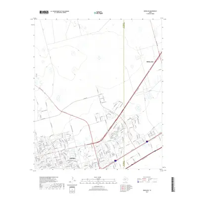
2019 Map of Odessa NE
USGS Topo · Published 2019About this map
The expanding city of Odessa meets the Ector Co Midland Co line in this western Texas landscape. This map documents the suburban growth of the Permian Basin, where residential streets like Boise Dr and Independence Dr push northward toward the open ranch land. A network of secondary roads and thoroughfares such as Ne Loop 338 and E Yukon Rd connect these growing neighborhoods to the wider region.
Find a feature on this map
54 named features on this map. Tap any name to fly to it.
Don’t see what you’re looking for? This feature index may not catch every label — zoom into the map to look around manually.
Map Details
Editions of this 2019 Odessa NE Map
This is the sole edition of this map. No revisions or reprints were ever made.
Other maps of this area

1954 · Hobbs
USGS Topo · 1:250,000

1954 · Pecos
USGS Topo · 1:250,000

1957 · Pecos
USGS Topo · 1:250,000

1958 · Hobbs
USGS Topo · 1:250,000

1964 · Odessa NE
USGS Topo · 1:24,000

1964 · Odessa SW
USGS Topo · 1:24,000

1964 · Odessa NW
USGS Topo · 1:24,000

1964 · Odessa SE
USGS Topo · 1:24,000

1964 · Parks
USGS Topo · 1:24,000

1965 · Southwest Midland
USGS Topo · 1:24,000