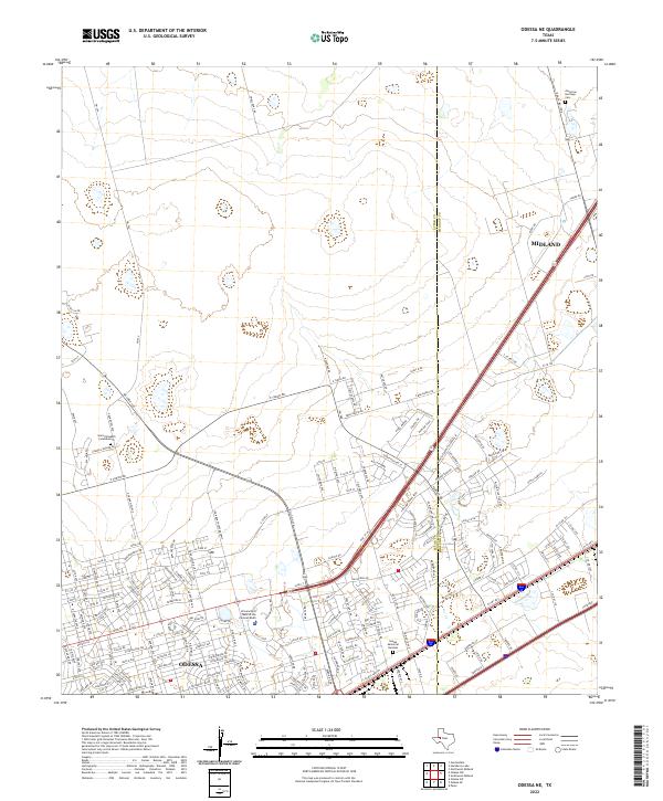
2022 Map of Odessa NE
USGS Topo · Published 2022About this map
The Ector Co Midland Co line divides this map, illustrating the continued suburban expansion between the two Permian Basin anchors. At the heart of this growth is the University of Texas of the Permian Basin, surrounded by a dense network of residential streets and arterial highways. The transition from the urban grid of Odessa to the more open ranch lands of Midland is marked by distinctive landmarks like Sunset Memorial Gardens and the Saint Elizabeth Columbarium. Farther north, the landscape retains traces of its agricultural roots with features like P Bar Ranch RD and Cross B RD. This 2022 survey captures the modern infrastructure of West Texas, including the major corridor of Hwy 191 W and the outlying American Heritage Cem, reflecting the region's 21st-century development patterns.
Find a feature on this map
134 named features on this map. Tap any name to fly to it.
Don’t see what you’re looking for? This feature index may not catch every label — zoom into the map to look around manually.
Map Details
Editions of this 2022 Odessa NE Map
This is the sole edition of this map. No revisions or reprints were ever made.
Other maps of this area

1954 · Hobbs
USGS Topo · 1:250,000

1954 · Pecos
USGS Topo · 1:250,000

1957 · Pecos
USGS Topo · 1:250,000

1958 · Hobbs
USGS Topo · 1:250,000

1964 · Odessa NE
USGS Topo · 1:24,000

1964 · Odessa SW
USGS Topo · 1:24,000

1964 · Odessa NW
USGS Topo · 1:24,000

1964 · Odessa SE
USGS Topo · 1:24,000

1964 · Parks
USGS Topo · 1:24,000

1965 · Southwest Midland
USGS Topo · 1:24,000