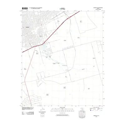
2010 Map of Odessa SE
USGS Topo · Published 2010About this map
Odessa expands into the Ector County plains in this 2010 survey, showing the transition from dense urban blocks to industrial and ranching lands. The landscape is defined by the legacy of West Texas energy and agriculture, with the Dora Roberts Oil Field occupying the eastern portion of the quadrangle while numerous named landmarks like Hendricks Windmills and the Shipping Pasture Windmill dot the open country. The arid geography is further marked by the seasonal paths of Muskingum Draw and Monahans Draw, which are intercepted by civil engineering features including Averitt Number 2 Dam and Averitt Number 3 Dam. Within the city limits, local landmarks such as Blackshear Stadium appear alongside significant transit corridors like SE Loop 338 S, providing a detailed view of the regional infrastructure as it stood at the start of the decade. Ranching family history is preserved through labels like Walters Ranch, illustrating the persistent connection between the town and its surrounding pastoral heritage.
Find a feature on this map
39 named features on this map. Tap any name to fly to it.
Don’t see what you’re looking for? This feature index may not catch every label — zoom into the map to look around manually.
Map Details
Editions of this 2010 Odessa SE Map
This is the sole edition of this map. No revisions or reprints were ever made.
Other maps of this area

1954 · Pecos
USGS Topo · 1:250,000

1957 · Pecos
USGS Topo · 1:250,000

1964 · Odessa NE
USGS Topo · 1:24,000

1964 · Odessa SW
USGS Topo · 1:24,000

1964 · Odessa NW
USGS Topo · 1:24,000

1964 · Odessa SE
USGS Topo · 1:24,000

1964 · Parks
USGS Topo · 1:24,000

1964 · Clark Brothers Ranch
USGS Topo · 1:24,000

1965 · Southwest Midland
USGS Topo · 1:24,000

1965 · South Cowden Ranch
USGS Topo · 1:24,000