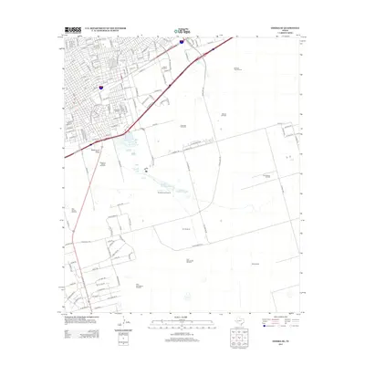
2012 Map of Odessa SE
USGS Topo · Published 2012About this map
Industrial expansion and resource extraction define this landscape on the southeastern edge of Odessa during the early 21st century. The map shows a transition from the dense residential and commercial grid of the city—anchored by landmarks like Blockshear Stadium—into a vast, sparsely populated area dedicated to ranching and energy production. The Dora Roberts Oil Field occupies a significant portion of the eastern landscape, illustrating the regional reliance on the petroleum industry.
Find a feature on this map
144 named features on this map. Tap any name to fly to it.
Don’t see what you’re looking for? This feature index may not catch every label — zoom into the map to look around manually.
Map Details
Editions of this 2012 Odessa SE Map
This is the sole edition of this map. No revisions or reprints were ever made.
Other maps of this area

1954 · Pecos
USGS Topo · 1:250,000

1957 · Pecos
USGS Topo · 1:250,000

1964 · Odessa NE
USGS Topo · 1:24,000

1964 · Odessa SW
USGS Topo · 1:24,000

1964 · Odessa NW
USGS Topo · 1:24,000

1964 · Odessa SE
USGS Topo · 1:24,000

1964 · Parks
USGS Topo · 1:24,000

1964 · Clark Brothers Ranch
USGS Topo · 1:24,000

1965 · Southwest Midland
USGS Topo · 1:24,000

1965 · South Cowden Ranch
USGS Topo · 1:24,000