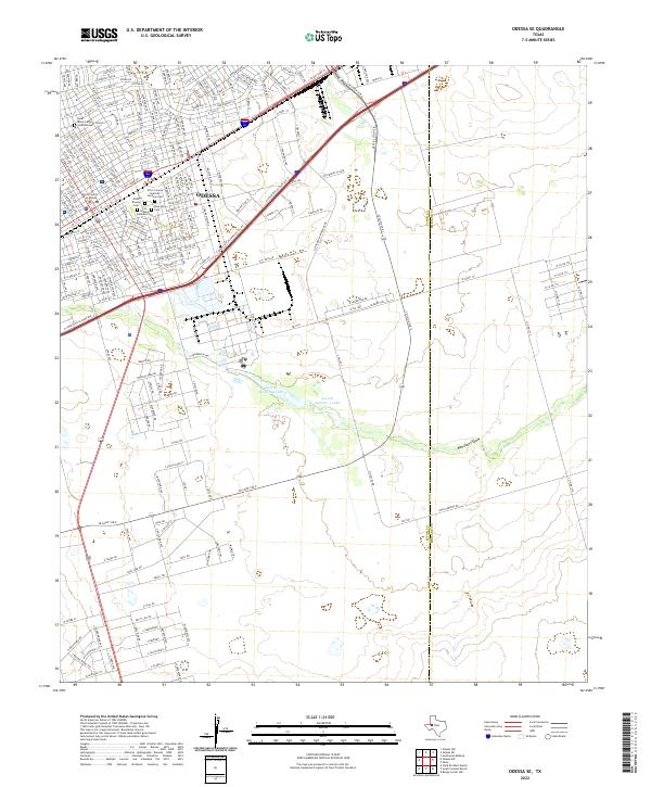
2022 Map of Odessa SE
USGS Topo · Published 2022About this map
Odessa centers this digital topographic survey, revealing a dense urban grid that transitions into the arid basins of West Texas. The civic heart of the area is defined by the Ector County Courthouse and a notable concentration of memorial sites, including Ector County Cem, Rose Hill Cem, and the Peaceful Gardens Cem. These locations provide a significant record for genealogical research in Ector County. Beyond the residential and commercial blocks of the city, the landscape is shaped by the intermittent drainage of Monahans Draw. In the southeastern portion of the quadrangle, Averitt Number 2 Lake and Averitt Number 3 Lake represent critical water management features in this semi-arid environment, illustrating the intersection of urban expansion and natural hydrology on the High Plains.
Find a feature on this map
98 named features on this map. Tap any name to fly to it.
Don’t see what you’re looking for? This feature index may not catch every label — zoom into the map to look around manually.
Map Details
Editions of this 2022 Odessa SE Map
This is the sole edition of this map. No revisions or reprints were ever made.
Other maps of this area

1954 · Pecos
USGS Topo · 1:250,000

1957 · Pecos
USGS Topo · 1:250,000

1964 · Odessa NE
USGS Topo · 1:24,000

1964 · Odessa SW
USGS Topo · 1:24,000

1964 · Odessa NW
USGS Topo · 1:24,000

1964 · Odessa SE
USGS Topo · 1:24,000

1964 · Parks
USGS Topo · 1:24,000

1964 · Clark Brothers Ranch
USGS Topo · 1:24,000

1965 · Southwest Midland
USGS Topo · 1:24,000

1965 · South Cowden Ranch
USGS Topo · 1:24,000