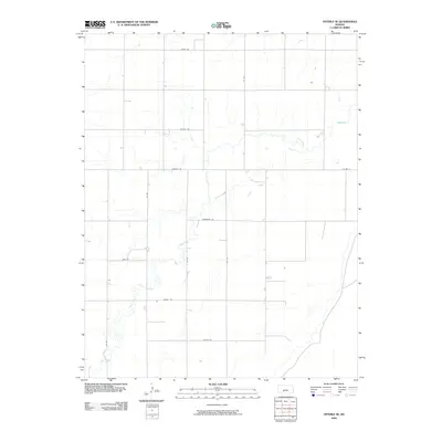
2009 Map of Offerle SE
USGS Topo · Published 2009About this map
Coon Creek meanders through the central and southern portions of this Ford County landscape, defining the local hydrology of the High Plains. The map reveals a strictly regulated section-line road network typical of Kansas agricultural development, where routes like Kettle Rd and Garnett Rd partition the terrain into precise grids. This 2009 survey by the U.S. Geological Survey captures a sparsely populated region characterized by industrial-scale farming and occasional family-named or descriptive routes such as Horseshoe Rd and Foothill Rd. The lack of dense town centers emphasizes the area's rural character, where local movement is dictated by these long, straight gravel and paved corridors connecting disparate farmsteads and field access points.
Find a feature on this map
14 named features on this map. Tap any name to fly to it.
Don’t see what you’re looking for? This feature index may not catch every label — zoom into the map to look around manually.
Map Details
Editions of this 2009 Offerle SE Map
This is the sole edition of this map. No revisions or reprints were ever made.
Other maps of this area

1889 · Kinsley
USGS Topo · 1:125,000

1892 · Kinsley
USGS Topo · 1:125,000

1892 · Spearville
USGS Topo · 1:125,000

1894 · Spearville
USGS Topo · 1:125,000

1894 · Kinsley
USGS Topo · 1:125,000

1955 · Pratt
USGS Topo · 1:250,000

1959 · Pratt
USGS Topo · 1:250,000

1969 · Bucklin NE
USGS Topo · 1:24,000

1969 · Greensburg NW
USGS Topo · 1:24,000

1969 · Bucklin NW
USGS Topo · 1:24,000