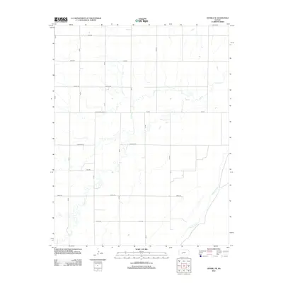
2012 Map of Offerle SE
USGS Topo · Published 2012About this map
The Arkansas River winds through the southeastern corner of this Ford County landscape, defining the local drainage and topography in an area dominated by an organized grid of section roads. This 2012 survey captures the rural character of the High Plains, where seasonal waterways like Coon Cr and Cow Cr traverse the open country. The road network is remarkably structured, featuring the prominent Correction Line Rd, which highlights the precise surveying required for land division in the American West. Key transit routes including Co Hwy-3 and Co Hwy-9 connect these agricultural lands, while descriptive names like Horseshoe Rd, Jewell Rd, and Kettle Rd provide identifiers for the local family farms and ranching properties that define the region's economy.
Find a feature on this map
18 named features on this map. Tap any name to fly to it.
Don’t see what you’re looking for? This feature index may not catch every label — zoom into the map to look around manually.
Map Details
Editions of this 2012 Offerle SE Map
This is the sole edition of this map. No revisions or reprints were ever made.
Other maps of this area

1889 · Kinsley
USGS Topo · 1:125,000

1892 · Kinsley
USGS Topo · 1:125,000

1892 · Spearville
USGS Topo · 1:125,000

1894 · Spearville
USGS Topo · 1:125,000

1894 · Kinsley
USGS Topo · 1:125,000

1955 · Pratt
USGS Topo · 1:250,000

1959 · Pratt
USGS Topo · 1:250,000

1969 · Bucklin NE
USGS Topo · 1:24,000

1969 · Greensburg NW
USGS Topo · 1:24,000

1969 · Bucklin NW
USGS Topo · 1:24,000