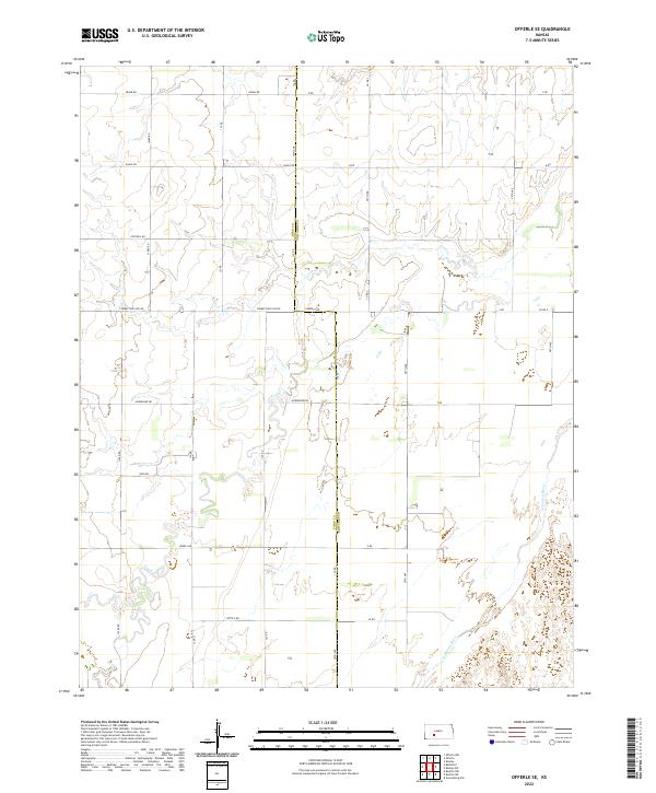
2022 Map of Offerle SE
USGS Topo · Published 2022About this map
The Arkansas River cuts across the southeastern corner of this landscape, carving a distinct riparian path through the gridded agricultural sections of Ford and Edwards counties. The terrain is defined by a systematic network of section roads like Correction Line Rd and Garnett Rd, reflecting the enduring legacy of the Public Land Survey System in western Kansas. While much of the land is partitioned for cultivation, the drainage of Coon Cr meanders through the western half, introducing natural variation to the otherwise geometric layout. This modern survey shows the persistent rural character of the region, where infrastructure is designed around the vast stretches of farmland between small townships. Family-named roads such as Horseshoe Rd and Kettle Rd provide localized landmarks for researchers tracing the development of regional transport and land use patterns.
Find a feature on this map
23 named features on this map. Tap any name to fly to it.
Don’t see what you’re looking for? This feature index may not catch every label — zoom into the map to look around manually.
Map Details
Editions of this 2022 Offerle SE Map
This is the sole edition of this map. No revisions or reprints were ever made.
Other maps of this area

1889 · Kinsley
USGS Topo · 1:125,000

1892 · Kinsley
USGS Topo · 1:125,000

1892 · Spearville
USGS Topo · 1:125,000

1894 · Spearville
USGS Topo · 1:125,000

1894 · Kinsley
USGS Topo · 1:125,000

1955 · Pratt
USGS Topo · 1:250,000

1959 · Pratt
USGS Topo · 1:250,000

1969 · Bucklin NE
USGS Topo · 1:24,000

1969 · Greensburg NW
USGS Topo · 1:24,000

1969 · Bucklin NW
USGS Topo · 1:24,000