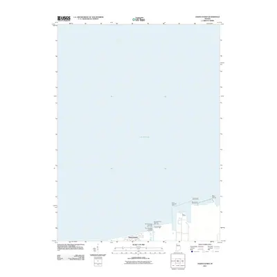
2011 Map of Ogden Dunes
USGS Topo · Published 2011About this map
Ogden Dunes sits on the southern edge of this maritime-focused survey, where the residential community meets the industrial infrastructure of the Indiana shoreline. The map is dominated by the waters of Lake Michigan, though it provides significant detail regarding the navigational aids necessary for entering the Port of Indiana. This industrial harbor is framed by a series of protective piers and light stations, including the Burns Harbor East Light and Burns Harbor North Light 2.
Find a feature on this map
12 named features on this map. Tap any name to fly to it.
Don’t see what you’re looking for? This feature index may not catch every label — zoom into the map to look around manually.
Map Details
Editions of this 2011 Ogden Dunes Map
This is the sole edition of this map. No revisions or reprints were ever made.
Other maps of this area

1900 · Toleston
USGS Topo · 1:62,500

1934 · Porter
USGS Topo · 1:48,000

1940 · Porter
USGS Topo · 1:62,500

1953 · Gary
USGS Topo · 1:24,000

1953 · Garyton
USGS Topo · 1:24,000

1953 · Ogden Dunes
USGS Topo · 1:24,000

1953 · Chesterton
USGS Topo · 1:24,000

1953 · Dune Acres
USGS Topo · 1:24,000

1953 · Chicago
USGS Topo · 1:250,000

1957 · Chicago
USGS Topo · 1:250,000