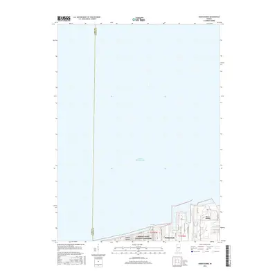
2016 Map of Ogden Dunes
USGS Topo · Published 2016About this map
Lake Michigan dominates this northern Indiana landscape, where the shifting sands of the Indiana Dunes National Lakeshore meet the heavy industrial infrastructure of the lakefront. The map shows the residential enclave of Ogden Dunes buffered by parkland, while just to the east, the massive footprints of Midwest Steel and Mittal Steel define the economic character of Portage. The layout of Burns Harbor reveals a transition from natural dunes to engineered ports and industrial grids. The southern shoreline is threaded with local routes like Shore Dr and George Nelson Dr, illustrating how human settlement and industry have tightly integrated into the narrow strip between the dunes and the water in the mid-2010s.
Find a feature on this map
23 named features on this map. Tap any name to fly to it.
Don’t see what you’re looking for? This feature index may not catch every label — zoom into the map to look around manually.
Map Details
Editions of this 2016 Ogden Dunes Map
This is the sole edition of this map. No revisions or reprints were ever made.
Other maps of this area

1900 · Toleston
USGS Topo · 1:62,500

1934 · Porter
USGS Topo · 1:48,000

1940 · Porter
USGS Topo · 1:62,500

1953 · Gary
USGS Topo · 1:24,000

1953 · Garyton
USGS Topo · 1:24,000

1953 · Ogden Dunes
USGS Topo · 1:24,000

1953 · Chesterton
USGS Topo · 1:24,000

1953 · Dune Acres
USGS Topo · 1:24,000

1953 · Chicago
USGS Topo · 1:250,000

1957 · Chicago
USGS Topo · 1:250,000