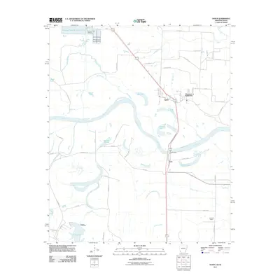
2011 Map of Ogden
USGS Topo · Published 2011About this map
Red River oxbows and floodplains dominate this borderland landscape between Arkansas and Texas, where the river's winding course defines the local geography. The settlement of Ogden sits as a central hub near the Thompson Subdivision, while the small community of Index marks the crossing point at the Index Bridge. This area is characterized by an intricate network of water bodies, including Winham Lake, Summer Hill Lake, and Cut-off Lake, which illustrate the river's historical shifts and the resulting wetland environment.
Find a feature on this map
61 named features on this map. Tap any name to fly to it.
Don’t see what you’re looking for? This feature index may not catch every label — zoom into the map to look around manually.
Map Details
Editions of this 2011 Ogden Map
This is the sole edition of this map. No revisions or reprints were ever made.
Other maps of this area

1909 · Texarkana
USGS Topo · 1:62,500

1950 · Ashdown East
USGS Topo · 1:24,000

1950 · Ashdown West
USGS Topo · 1:24,000

1950 · Ogden
USGS Topo · 1:24,000

1950 · Red Bluff
USGS Topo · 1:24,000

1950 · Barkman
USGS Topo · 1:24,000

1951 · Ashdown West
USGS Topo · 1:24,000

1951 · Ogden
USGS Topo · 1:24,000

1951 · Red Bluff
USGS Topo · 1:24,000

1951 · Ashdown East
USGS Topo · 1:24,000