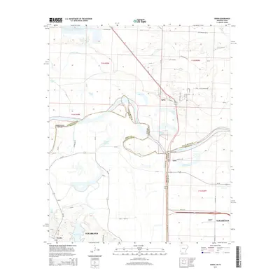
2014 Map of Ogden
USGS Topo · Published 2014About this map
The Red River meanders through the heart of this Arkansas-Texas borderlands survey, defining the complex boundary between Bowie Co and Little River Co. The landscape is dominated by the river's shifting path and the numerous oxbow lakes it has left behind, such as Cut-off Lake and Mill Lake. The small community of Ogden sits just north of the river, while Index marks the historic crossing point near the Index Bridge. Further south, the map captures the northern fringes of Texarkana, where suburban expansion meets the water at Bringle Lake. This area shows a mix of heavy industrial features like the Nacoosa Paper Retention Pond and local infrastructure such as the Flying W Airport. The intricate network of county roads, including Shepherd-Day Rd and FM-1397, provides a detailed view of the rural homesteads and agricultural tracts scattered throughout the river bottomlands.
Find a feature on this map
73 named features on this map. Tap any name to fly to it.
Don’t see what you’re looking for? This feature index may not catch every label — zoom into the map to look around manually.
Map Details
Editions of this 2014 Ogden Map
This is the sole edition of this map. No revisions or reprints were ever made.
Other maps of this area

1909 · Texarkana
USGS Topo · 1:62,500

1950 · Ashdown East
USGS Topo · 1:24,000

1950 · Ashdown West
USGS Topo · 1:24,000

1950 · Ogden
USGS Topo · 1:24,000

1950 · Red Bluff
USGS Topo · 1:24,000

1950 · Barkman
USGS Topo · 1:24,000

1951 · Ashdown West
USGS Topo · 1:24,000

1951 · Ogden
USGS Topo · 1:24,000

1951 · Red Bluff
USGS Topo · 1:24,000

1951 · Ashdown East
USGS Topo · 1:24,000