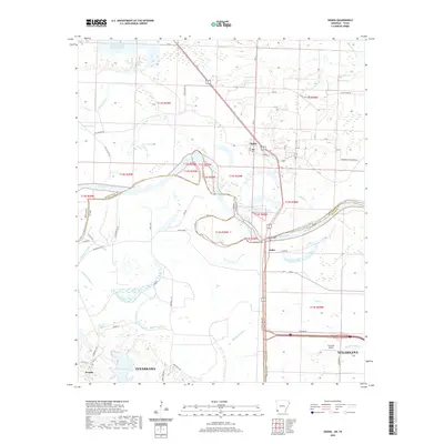
2020 Map of Ogden
USGS Topo · Published 2020About this map
The Red River carves a complex path through this 2020 map, defining the boundaries where Little River Co meets Bowie Co and Miller Co. The landscape is dominated by the shifting river hydrology, evidenced by numerous oxbow features and water bodies such as Pleasant Lake, Cut-off Lake, and Winham Lake. To the north, the confluence with the Little River adds to the intricate network of tributaries like Mill Br and Haney Creek.
Find a feature on this map
68 named features on this map. Tap any name to fly to it.
Don’t see what you’re looking for? This feature index may not catch every label — zoom into the map to look around manually.
Map Details
Editions of this 2020 Ogden Map
This is the sole edition of this map. No revisions or reprints were ever made.
Other maps of this area

1909 · Texarkana
USGS Topo · 1:62,500

1950 · Ashdown East
USGS Topo · 1:24,000

1950 · Ashdown West
USGS Topo · 1:24,000

1950 · Ogden
USGS Topo · 1:24,000

1950 · Red Bluff
USGS Topo · 1:24,000

1950 · Barkman
USGS Topo · 1:24,000

1951 · Ashdown West
USGS Topo · 1:24,000

1951 · Ogden
USGS Topo · 1:24,000

1951 · Red Bluff
USGS Topo · 1:24,000

1951 · Ashdown East
USGS Topo · 1:24,000