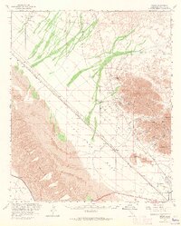
1963 Map of Ogilby
USGS Topo · Published 1965About this map
The Cargo Muchacho Mts dominate the eastern landscape of this arid Imperial County region, serving as a hub for extensive mining operations during the mid-20th century. Numerous claims such as the American Girl Mine, Tumco Mine, and La Colorado Mine are documented throughout the hills, reflecting the intense geological interest of the era. The infrastructure of the Southern Pacific railroad cuts a diagonal line across the desert floor, connecting small sidings and settlements like Clyde, Cactus, and Ogilby. To the south, the All American Canal and the Coachella Canal introduce industrial water management to the desert landscape, skirting the edge of Pilot Knob Mesa. Genealogists will find particular value in the documentation of the Hedges (Site) and the dedicated Hedges Cem and Ogilby Cem, which mark the community and labor history of these desert outposts.
Find a feature on this map
38 named features on this map. Tap any name to fly to it.
Don’t see what you’re looking for? This feature index may not catch every label — zoom into the map to look around manually.
Map Details
Editions of this 1963 Ogilby Map
2 editions found
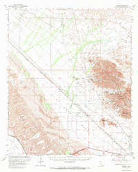
Other maps of this area

1903 · Yuma
USGS Topo · 1:125,000

1905 · Yuma
USGS Topo · 1:125,000

1907 · Holtville
USGS Topo · 1:125,000

1940 · Yuma
USGS Topo · 1:62,500

1942 · El Centro
USGS Topo · 1:250,000

1942 · Yuma
USGS Topo · 1:250,000

1942 · Blythe
USGS Topo · 1:250,000

1945 · Picacho Peak
USGS Topo · 1:62,500

1945 · Picacho
USGS Topo · 1:62,500

1945 · Yuma
USGS Topo · 1:62,500