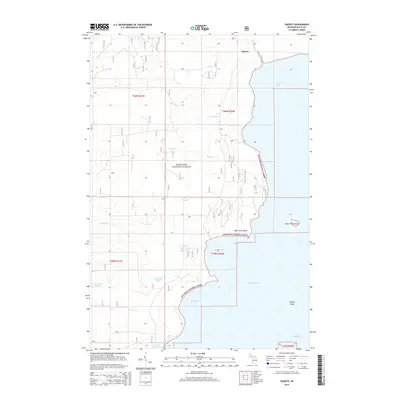
2014 Map of Ogontz
USGS Topo · Published 2014About this map
Ogontz stands near the northern reaches of Ogontz Bay, marking a quiet interface between the timbered interior and the expansive waters of Big Bay de Noc. This 2014 survey documents a landscape defined by its hydrology, where the Big River and Little River wind through the eastern portions of the Hiawatha National Forest. The geography here is notably fragmented by water, from the small inland basins of Boufford Lake and Indian Town Lake to the prominent coastal features of Saint Vital Point and Saint Vital Island. The map illustrates a network of forest roads and township lines that organize this corner of Delta County, revealing the persistence of traditional land divisions. Coastal hazards like Ripley Shoal and protected areas such as Sand Bay highlight the region's relationship with Lake Michigan, serving as a modern record of a timeless Upper Peninsula shoreline.
Find a feature on this map
21 named features on this map. Tap any name to fly to it.
Don’t see what you’re looking for? This feature index may not catch every label — zoom into the map to look around manually.
Map Details
Editions of this 2014 Ogontz Map
This is the sole edition of this map. No revisions or reprints were ever made.
Other maps of this area

1932 · Rapid River NE
USGS Topo · 1:31,680

1932 · Burnt Bluff NW
USGS Topo · 1:31,680

1932 · Garden NW and SW
USGS Topo · 1:31,680

1932 · Rapid River NW
USGS Topo · 1:31,680

1932 · Rapid River SE
USGS Topo · 1:31,680

1932 · Rapid River SW
USGS Topo · 1:31,680

1954 · Escanaba
USGS Topo · 1:250,000

1957 · Escanaba
USGS Topo · 1:250,000

1958 · Escanaba
USGS Topo · 1:250,000

1958 · Garden
USGS Topo · 1:62,500