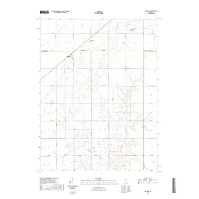
2021 Map of Ohlman
USGS Topo · Published 2021About this map
The settlement of Ohlman serves as the focal point for this 2021 survey, situated at the crossroads of a dense agricultural grid where Montgomery, Christian, and Shelby counties converge. This prairie landscape is defined by its subtle drainage patterns, with the S Fork Sangamon River cutting across the northwest corner and the headwaters of Ramsey Cr and Elliott Cr carving shallow valleys through the surrounding farmland. These watercourses historically dictated the placement of early homesteads and cemeteries, such as the Rosemond Grove Cem and Zion Cem, which remain as vital markers of the area's pioneer heritage.
Find a feature on this map
64 named features on this map. Tap any name to fly to it.
Don’t see what you’re looking for? This feature index may not catch every label — zoom into the map to look around manually.
Map Details
Editions of this 2021 Ohlman Map
This is the sole edition of this map. No revisions or reprints were ever made.
Other maps of this area

1944 · Ramsey
USGS Topo · 1:62,500

1946 · Ramsey
USGS Topo · 1:62,500

1946 · Nokomis
USGS Topo · 1:62,500

1947 · Pana
USGS Topo · 1:62,500

1947 · Hillsboro
USGS Topo · 1:62,500

1949 · Hillsboro
USGS Topo · 1:62,500

1949 · Nokomis
USGS Topo · 1:62,500

1949 · Pana
USGS Topo · 1:62,500

1958 · Decatur
USGS Topo · 1:250,000

1961 · Decatur
USGS Topo · 1:250,000